
By Majorca Daily Bulletin reporter
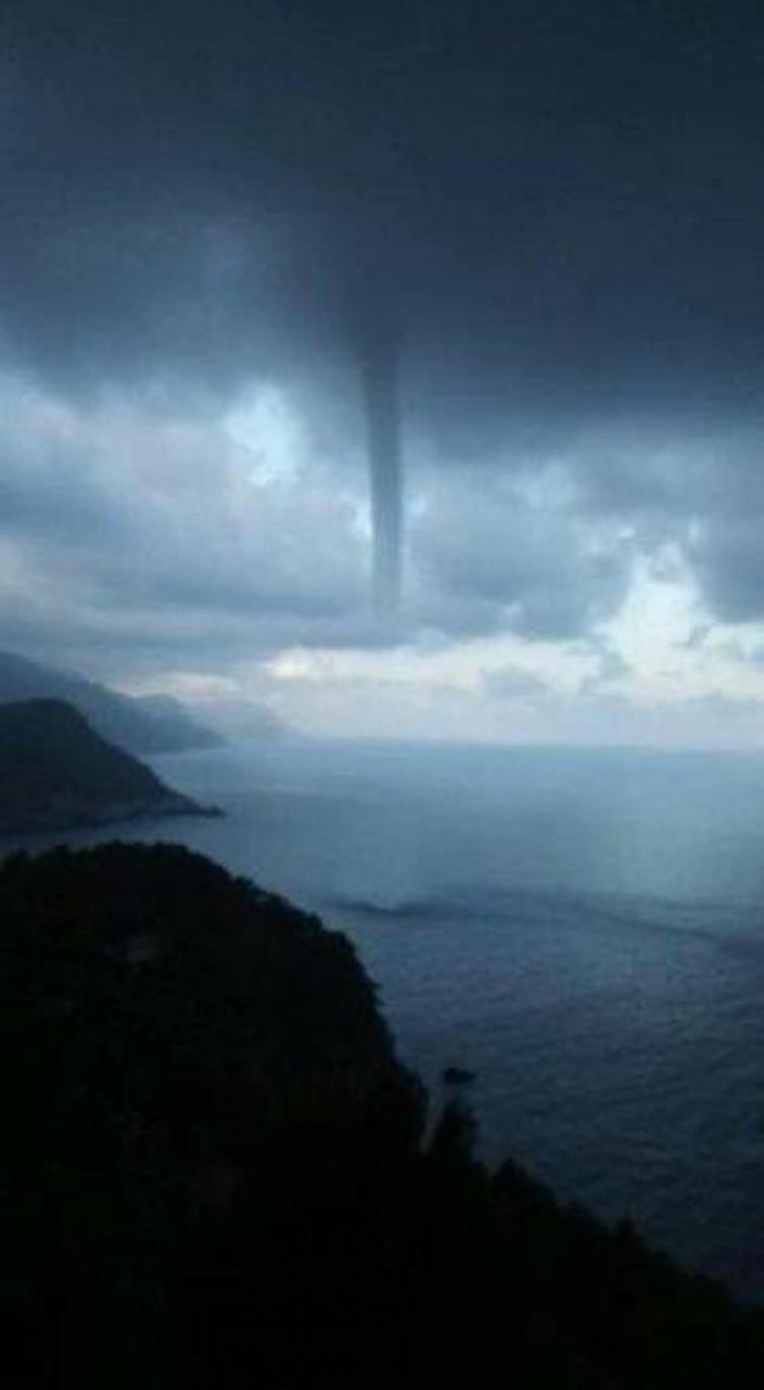
Thunderstorms were recorded overnight and in the early hours of this morning across most of Mallorca, especially in the Serra de Tramuntana area and IB3 has tweeted stunning footage of a tornado off the coast of Banyalbufar.
És la mànega marina que s'ha format davant la costa de Banyalbufar de fa uns minuts.
— El temps IB3 (@TempsIB3) September 10, 2021
Tot i les clarianes d'aquesta hora a molts punts de l'arxipèlag, a les properes hores: continuen els ruixats i tempestes, fenòmens irregular però intensos.
📹Gonzalo Valencia pic.twitter.com/uIBBhDwbv9
Thunderstorms at sea are created from vertically developing clouds, which are formed by a column of warm, humid air that rises in a rotating spiral from the water to the base of the cloud.
“The bottom of a tornado usually consists of sprayed water and the column tends to become more and more inclined over time due to wind in the lower layer below the storm or parent cloud,” explains Aemet. “In general, they do not reach the size and wind speed of typical land tornadoes, are relatively short-lived and don't exceed the EF0 category of the improved Fujita scale.”
The unstable weather is forecast to continue throughout Friday with scattered showers and storms which could be intense in some places.
September 10, 2021 at 01:59PM
via Majorca Daily Bulletin News Feed read more...


0 Comentarios